Virtual Logistics - A Solution for the Future
Posted on Tuesday, December 8th
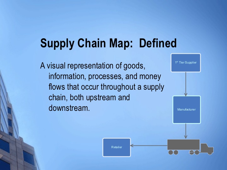
Handling the logistics of any type of shipping operation is no easy job. There are large numbers of different factors that must be considered in the process, from the equipment available for shipping to the infrastructure available at the time of a shipment. However, the concept of virtual logistics appears to provide a solution to reduce at least some of the hassle that comes with this type of activity, especially with emergency operations. For starters, let us go through the steps of making a delivery between points A and B. As any logistician would probably confirm, the first thing that is needed is comprehensive supply chain data. This includes a wide range of details, from tonnage requirements to locations where commodities can be stored to potential cost effective choices of routes, among many others. Indeed, this kind of data is currently available. However, it must be collected from various systems, which causes the whole logistics process to be very cumbersome. Therefore, as expected, various solutions are sought to simplify this process as much as possible. For starters, the Supply Chain Maps provide one solution. These maps allow the tracking of any field supply chain operations carried out within a specific country once the commodities have reached a port of entry by ensuring centralised access to operational data in real time. This includes a variety of factors, such as estimated times of arrival at the port, lead times, active transport corridors, stocks available in ports and warehouses, en-route cargo, among others. In addition to this, it should be noted that this operational data includes both current and historical data to allow shipments to be tracked over a period of two years. Exceptional situations such as the Sahel crisis, for instance, have provided a context for the improvement of such solutions so that supply chain operations can be tracked within entire regions to facilitate the planning of an international logistics response. Once again, the data provided in this context includes active transport corridors, ports and warehouses, tonnage requirements and time factors, among other factors that play an essential role in the operational planning process. According to experts who have used the Supply Chain Maps as a logistics solution, there is one particular feature that has proven to be particularly useful. That would be the lead time module. This feature allows a more accurate estimation of the times of arrival at extended delivery points, where commodities are handed over to an implementing partner, the beneficiary or a non-governmental organization. Consequently, it also allows a more accurate assessment of the feasibility of various distribution plans based on various time frames. In fact, experts in the field agree that the entire solution provided by the Supply Chain Maps sets itself apart as highly practical and very easy to use, even by people with limited experience in the field of logistics. The explanation is quite straightforward, the design of the Supply Chain Maps being completely visual.